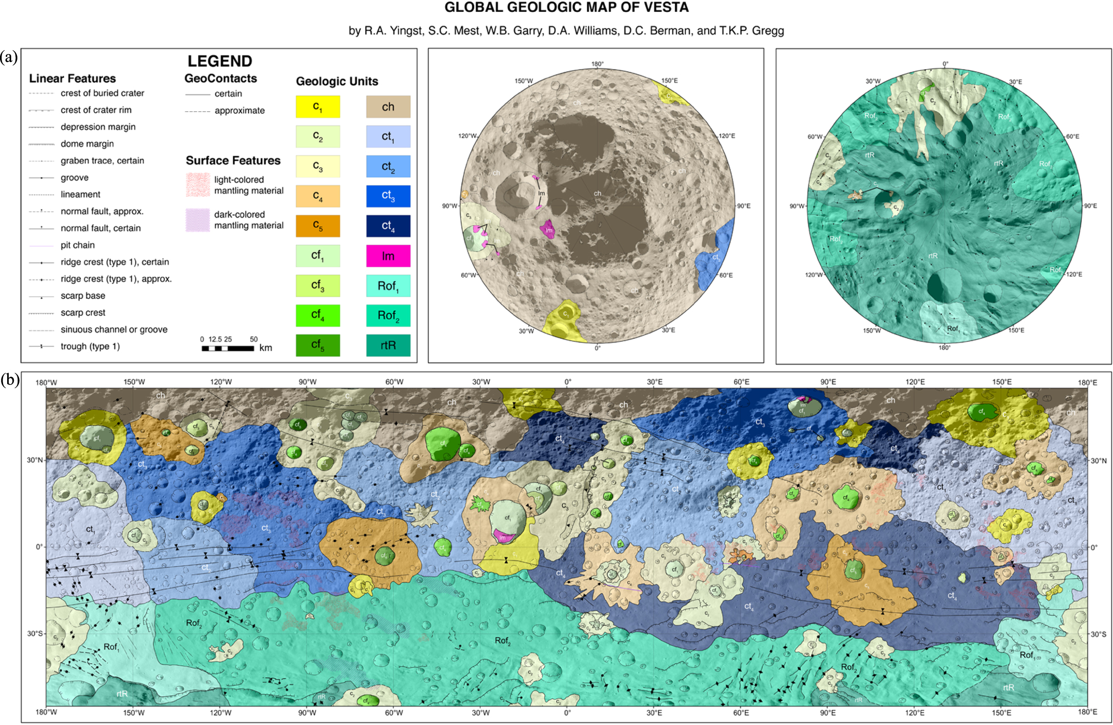
The final hybrid map, showing Vesta’s polar regions in the top two views and equatorial regions at the bottom. Click for high-resolution version. [Yingst et al. 2023]
In 2011, the Dawn spacecraft began its 14-month survey of the minor planet Vesta, giving us the clearest look yet at Vesta’s surface. Dawn collected data on Vesta’s surface color, roughness, and composition, and mapped its large-scale surface features. While these observations presented an excellent opportunity to study one of the largest objects in the asteroid belt, it also presented a challenge: how do you combine different types of data to maximize the amount of information presented? Using data from the Dawn mission,
Aileen Yingst (Planetary Science Institute) and collaborators first made two separate maps that divided Vesta’s surface into dozens of regions based on 1) the color of the surface and 2) large-scale surface features like craters. To combine these maps into one hybrid map, shown above and to the right, the team used a decision tree to determine how to combine the different data sets to characterize each region. The resulting map includes 18 types of terrain, distinguished by both the type of landform (craters, highlands, and more) and the color. For more details about this mapping method and what it revealed about Vesta’s surface, be sure to read the full research article linked below.
Citation
“A Geologic Map of Vesta Produced Using a Hybrid Method for Incorporating Spectroscopic and Morphologic Data,” R. Aileen Yingst et al 2023 Planet. Sci. J. 4 157. doi:10.3847/PSJ/acebe9